Thursday, December 29, 2011

Sacsayhuaman near Cuzco


The Urubamba River.


The Urubamba River valley seen from Machu Picchu.


The sacred Urubamba River valley, the trail of Viracocha. (Click to enlarge).


The fortress of Sacsayhuaman.


Doorway up on the 2nd level.


Sacsayhuamán: the remains of a tower.

"It was in this area of Cuzco in 1463 that the Inca rose to power, obviously utilizing a series of buildings, temples, and other magnificent structures, including the fortress of Sacsahuaman, the much earlier Nephites left behind. Since at no time in the scriptural record do we find the Lamanites constructing buildings, roads, palaces, or other magnificent edifices, we must conclude that the ancient workmanship of the Andean Plateau, from Tehuantepec (Lake Titicaca) to Sacsahuaman (Cuzco) to Pachacamac (Lima) were built by the ancient Nephites."

Wednesday, December 28, 2011

Inti-Raymi, Festival of Incas


"In the town of Cusco, in the early 15th century, the area was ruled by a younger son of the ruler. In 1438, he defeated the Chanca people, a neighboring tribe and gave himself the tile of Pachacuti, meaning, transformer of the earth. He then started a huge process of military expansion. This was later continued by his son Topa Inca."


The Inca king during the Festival of the Sun, Inti-Raymi. "Prior to the arrival of the Spanish in the 16th century, northern Chile was under Inca rule while the indigenous Mapuche inhabited central and southern Chile".


Valparaiso, Chile - The Mapuche Indians


Calendario Mapuche, Chile. The Mapuche calendar.


Mapuche women from Valparaiso, Chile.


A Mapuche ceremony.

Tuesday, December 27, 2011

Lehi - First Landing


"While we think of South America as individual countries today, in 600 BC., the area along the western strip, usually referred to as the Andean area, was one continuous, unbroken wilderness (uninhabited), with tall cliffs along the Pacific shore with only a few areas suitable for landing a group of people from a deep-sea, ocean-going vessel. That area is today called the Bay of Coquimbo, which is situated exactly along the 30º south latitude, in what is today the country of Chile. Several things work for this area being the landing site of the Lehi Colony."


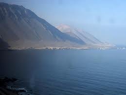
Coastal view of Chile.


"There is impressive evidence that Joseph Smith identified the coast of Chile at about 30 degrees south latitude as the place where Lehi's group made landfall in the New World.11 From this southern extreme the Nephites and Lamanites eventually ranged at least 6,000 miles north to New York State, where Smith located the "Hill Cumorah," site of the epic Nephite-Lamanite battle of extinction, near his boyhood home of Palmyra, New York. LDS apostle Joseph Fielding Smith (latter 10th President of the LDS Church) affirmed that the location of Cumorah in Palmyra, New York was the unquestioned teaching of Joseph Smith and successive Mormon presidents and apostles."

"LEHI'S TRAVELS — Revelation to Joseph the Seer. The course that Lehi and his company traveled from Jerusalem to the place of their destination: They traveled nearly a south, southeast direction until they came to the nineteenth degree of north latitude; then, nearly east to the Sea of Arabia, then sailed in a southeast direction, and landed on the continent of South America, in Chili [sic], thirty degrees south latitude."

Peru - Ancient Megalithic Stonework

Tuesday, December 20, 2011

Mormon Seer Stones


The Anthon transcript of Book of Mormon characters copied from the gold plates by Joseph Smith Jr.


Daguerreotype of the Prophet Joseph Smith Jr.


The gold plates of the Book of Mormon.


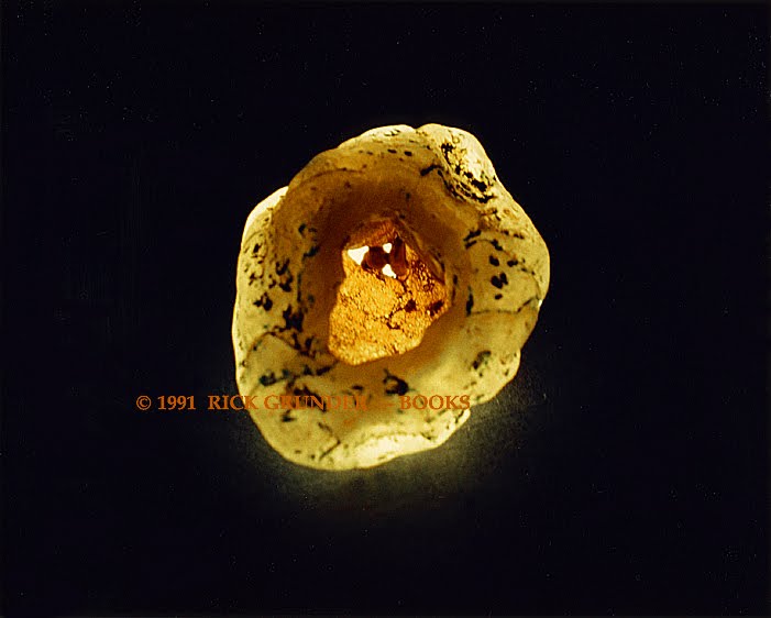
1.Green seer stone owned by Utah pioneer Philo Dibble. Matches description of stone given to Joseph Smith by Jack Belcher in Pennsylvania in the 1820's. Dibble family folklore includes story of Philo receiving stone from Joseph.
According to the Princeton Library Curator of Rare Books, the stone is privately owned and was loaned to the Library in 1980 for an exhibition entitled "A Quorum Called Out of the Kingdom" (documented in Princeton University Library Chronicle XLII, 1 (Autumn, 1980) pp. 55-59.

2. Sandy colored seer stone apparently used by Joseph Smith. Smith's widow Emma passed it on to relatives of her second husband, Lewis Bidamon. (Wilford Wood Museum)
Below.


Whitmer stone.
3. Stone of David Whitmer, who was a special witness to the Book of Mormon.
(LDS Photo Archives)

4. Stone of Jacob Whitmer, son of David, and special witness to the Book of Mormon
(Rick Grunder - Books)


Seer Stones


The Seer Stone of Joseph Smith.


Joseph Smith Jr. using the Urim and Thummim set in spectacles and attached to the breastplate that was found with the gold plates.

Salt Lake City

Wilford Woodruff Journal, 11 December 1869
In his journal, Wilford Woodruff recounted what he had heard Brigham Young say about the cave:

President Young said in relation to Joseph Smith returning the Plates of the Book of Mormon that He did not return them to the box from wh[ence?] He had Received [them]. But He went [into] a Cave in the Hill Comoro with Oliver Cowdry & deposited those plates upon a table or shelf. In that room were deposited a large amount of gold plates Containing sacred records & when they first visited that Room the sword of Laban was Hanging upon the wall & when they last visited it the sword was drawn from the scabbard and [laid?] upon a table and a Messenger who was the keeper of the room informed them that that sword would never be returned to its scabbard untill the Kingdom of God was Esstablished upon the Earth & untill it reigned triumphant over Evry Enemy. Joseph Smith said that Cave Contained tons of Choice Treasures & records.

The LDS "Metal Library" is in a cave within the Hill Cumorah.